Beyond Tiki, Bilge, and Test / Beyond Tiki
Off-topic but fascinating -- maps.google.com street photos
Pages: 1 3 replies
|
J

JanetMermaid
Posted
posted
on
Fri, Apr 18, 2008 4:42 PM
I was searching for the zip code of one of our clients and discovered that Google maps had a picture of her house. Fascinated, I started entering addresses for places I know, live, have lived, etc. Almost all of them include a photo of the street, with zoom/pan/tilt/etc. options so you can actually look directly at any house on that street. It's fascinating and also kinda creepy -- someone had to drive all over these streets, taking pictures every few yards. Thought I'd share this here for those who don't know about it. Try entering your address -- not all streets have been mapped, but certainly most in Austin have. |
|
TD

TIKI DAVID
Posted
posted
on
Mon, Apr 21, 2008 7:52 PM
BOO! |
|
D

Digitiki
Posted
posted
on
Tue, Apr 22, 2008 8:37 AM
You gotta check out googlesightseeing.com It is a gallery of weird and unusual pictures snapped by Google Earth and Google Maps! Very interesting stuff. |
|
TG

The Gnomon
Posted
posted
on
Tue, Apr 22, 2008 8:38 AM
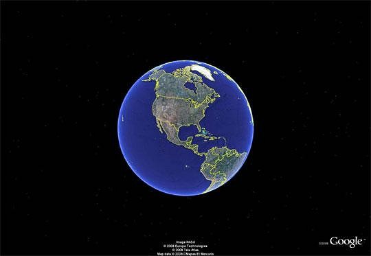
Then you'll love Google Earth. I've been running Google Earth Plus for a long time (might get Pro soon). There is a free version. Plus only costs $20 a year. In Google Earth you can "fly" from place to place, you can create tours, and do lots of stuff with it. The Plus version lets you print out at higher resolution and the Pro version at the highest resolution. When you generate driving directions between places, you can run a tour of the route. It will "fly" you from each turning point to the next throughout the entire trip. It would take a lo-o-o-ong time to summarize the features of Google Earth. Anyway, if you like Google maps, you'll definitely want Google Earth. Here is the view I get when I launch it. I have my settings to view roads, geographical borders, place names, etc. It only shows you certain ones when you drill into certain altitudes where they are allowed to reveal themselves. There are innumerable defaults that can be changed to suit your preferences. For example you can change the altitude that a flight takes during a tour and the angle of view.
I've double clicked on my office, so it will begin to descend to that location. I'll stop it along the way a few times. Here we are moving in toward the Eastern US.
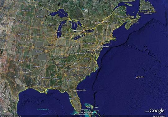
Here we are approaching the Greater Washington National Capital Area & Vicinity.
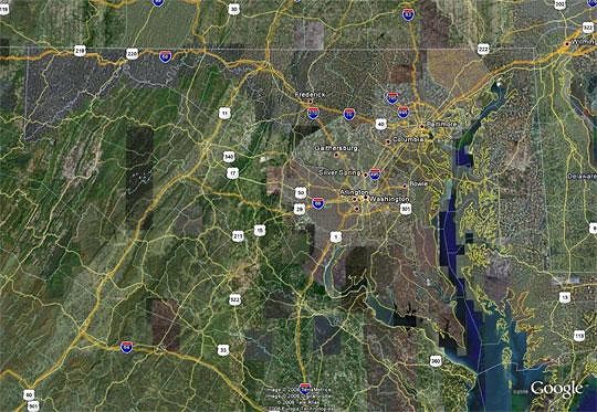
This is a view of Reston, VA just outside of Washington to the west.
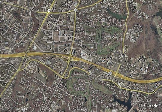
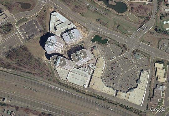
And here is my office complex (Plaza America) which includes a shopping center where there's a Starbucks (of course), a Food Whole, and a Michael's craft store, plus a few eateries and other stores.
[ Edited by: The Gnomon 2008-04-22 08:43 ] |
Pages: 1 3 replies