Tiki Central / Locating Tiki / South Seas Club, Anchorage, AK (bar)
Post #541675 by TabooDan on Sat, Jul 10, 2010 3:55 PM
|
T

TabooDan
Posted
posted
on
Sat, Jul 10, 2010 3:55 PM
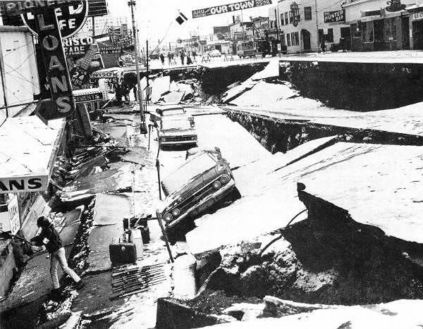
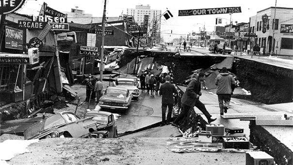
I just found out about this, some of you might know, but here's the reason I think we won't find too much to do with the area of old 4th Avenue we want to see: "The Alaskan earthquake occurred on Good Friday, March 27, 1964, at 5:36 PM local time. It was the largest earthquake ever recorded in North America. Duration estimates range from 3 to 5 minutes. Sources vary as to the magnitude of this earthquake, in part because a variety of scales are used to measure earthquakes. Bruce Bolt lists it as 8.6 Ms, where Ms is the surface-wave magnitude. The USGS gives it a 9.2 Mw, where Mw is the moment magnitude. The epicenter was located between Valdez and Anchorage, near Prince William Sound. The sudden uplift of the Alaskan seafloor caused a tsunami, which was responsible for 122 of the 131 deaths. The tsunami propagated at speeds over 400 miles per hour. The tsunami reached the Hawaiian Islands. I think that gives meaning to there goes the neighborhood!!
Some areas of the roadway sank over 15 feet! Here's another:
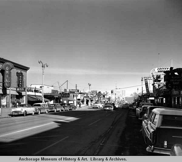
I could not find any pictures of the area we want to see but it is possible that the area was damaged. Some of the buildings in that area would have been over 22 years at least by the time the earthquake came. Alot of the bigger buildings and blocks were being built around 1912-1917. Looks like our little building that housed the bar was destroyed at one time or another. Google maps now just shows car parking in that area between G and H streets along 4th Avenue. Well, I think this is about all the digging I'm gonna do on this place. It is very hard to see but in this picture which is around 1957, I think you can just make out the shape of the top of the Palm Tree sign way off to the right. Look just to the right of the tall building in the center of the background:
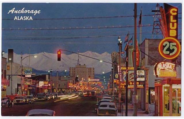
Like I said, hard to see but it looks like the same shape. I also thought this was a good postcard of some of the signs along 4th Avenue:
Somewhere along here was the Club we want to find out about. Thought it was cool to see the colored signs and nice cars from the same period!! I'm outta here! [ Edited by: TabooDan 2010-07-10 15:56 ] |