Tiki Central / Tiki Travel / Club Nouméa's Rarotongan Tiki Tour
Post #768852 by Club Nouméa on Wed, Sep 21, 2016 7:56 AM
|
CN

Club Nouméa
Posted
posted
on
Wed, Sep 21, 2016 7:56 AM
Rarotonga Past & Present
Circa 1250, a Tahitian chief called Tangiia was forced to flee his homeland due to an ongoing feud with his brother. Tangiia took various of his people with him and, along with a party of warriors sailing from Samoa who he encountered in mid-ocean, occupied lands on Rarotonga by force of arms, lastingly affecting the balance of power on the island, with the Tahitians and Samoans becoming the new overlords. Tangiia is said to have been responsible for the establishment of the marae (meeting place) of Arai-Te-Tonga, a few kilometres to the east of Avarua, on the edge of the Ara Metua, a paved road that ran around Rarotonga:
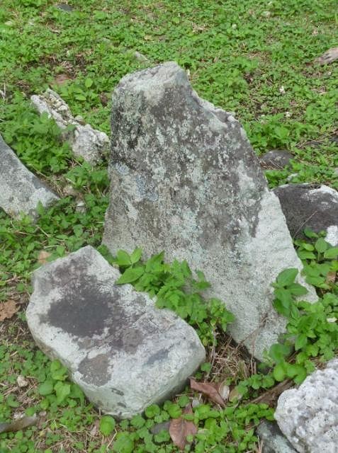
This panoramic shot was taken on the path of the old Ara Metua (you can see the modern road running parallel to it). As can be seen, the sides of the Ara Metua were marked with various stones, which were where chiefs, dignitaries and taunga or priests sat during ceremonies. Arai-Te-Tonga was also a place of human sacrifice. There is no reference to this on the orientation board at the site, but if my reading of an old map made by S. Percy Smith in 1897 is correct, this is the "maringi-toto" or blood-spilling stone, where the victims for beheading ended up:
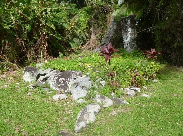
The chief's platform is surmounted by a substantial slab of stone that is said to have been transported all the way from Hawaii, indicative of the mana of both Tangiia and this site.
This important historic marae is now within the domain of the tribe of Arai-te-Tonga-Avarua. Arai-Te-Tonga is the easiest of the ancient marae sites to find on Rarotonga, being a breezy walk eastwards along the sleepy back road of Avarua. It is also the only of the marae sites I saw that had an orientation board that provided background information about the site, even if the current ariki are understandably reluctant to indicate the power of life and death their forebears had over past generations... Further eastwards, around Matavera way, is another ancient marae, called Porotaka:
There was no orientation board here, although the layout is fairly straightforward, with the marae consisting of a stony area with seats laid out around the edges, with the local ariki's seat being at the top, and his subordinates' seats being arranged to the left and right of him:
I was told by a local that the structure behind the marae dates from European times and was once the home of the local ariki, probably late 19th to early 20th century:
I spent a not-so-lazy Sunday afternoon looking for the third ancient marae site I visited on the island, catching a bus over to the southern lagoon where I stopped for my lunch:
And where I made a new friend:
After lunch and farewelling my friend, I went off to look for the district tourist orientation board on the main road that was supposed to show where one of Rarotonga's oldest maraes was located. I ended up walking westwards, and took some lovely photos...
... but concluded I must have walked right past the district's orientation board as I was already in the next district by the time I took that photo. Backtracking, and trying to recall the position I had seen on a map back at the motel, I eventually concluded that the board in question no longer existed and headed inland, resolving to find the marae without a map. All I had to go on was a vaguely remembered map I had seen in a Lonely Planet guide back in Wellington, but surely it couldn't be that hard to find... My path took me through fertile agricultural lands. July is mid-winter in the southern hemisphere, but here on Rarotonga I saw tomatoes and bell peppers growing alongside bananas and plantains. On a hunch, I decided to wander up an agricultural road that led to the top of the valley, but ended up at a dead-end in a field of taro:
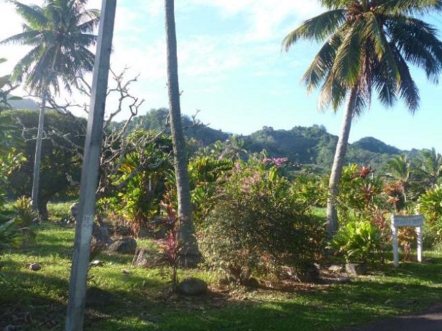
The hills look enticing but the marae in question was on the flat, so I backtracked to the tarsealed road I had been on and began looking eastwards. After 2 hours of looking, there it was:
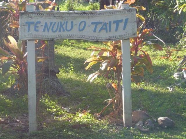
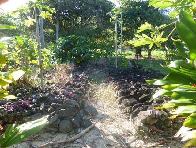
"The Isle of Tahiti". I would like to tell you how old this marae is, but information was not forthcoming:
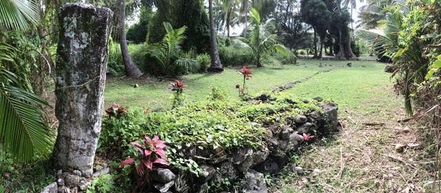
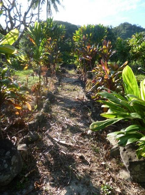
Judging from the name referencing Tahiti however, this is one of the oldest maraes on the island. A central avenue led directly up to where the chief used to sit:
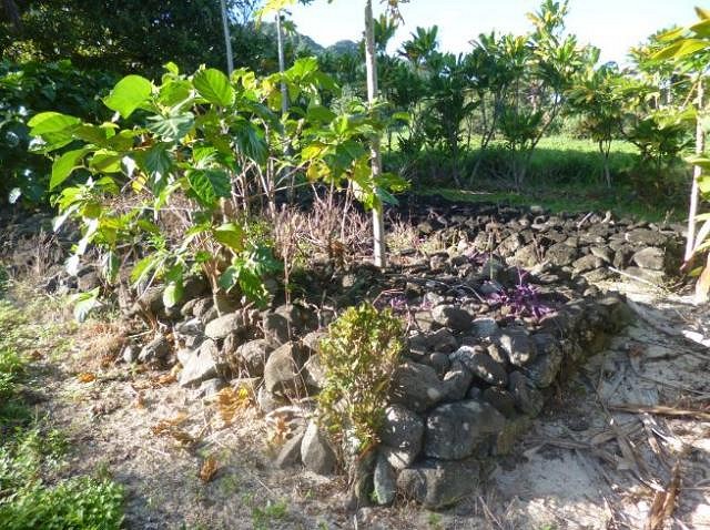
Half-way up, the chief's platform becomes visible. It is shaped like a long-sided staple:
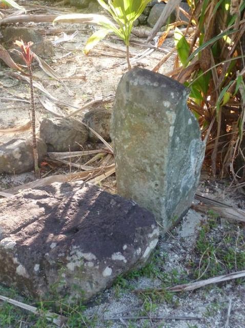
To the left, in front of the chief's platform, was another suspicious looking stone that was too oddly-shaped to be a seat. This looks very much like another "maringi-toto" or blood-spilling stone for sacrificial victims:
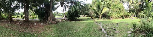
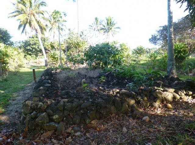
View from behind the chief's platform, looking back towards the road:
I paused here for a drink and sat for a while and contemplated the quiet beauty of the place. Although it looks flat, the site is on fairly high land and you could see back down the valley to the lagoon in-between various of the trees. Looking at the clock it was getting near 5 pm, which meant that the last of the Sunday buses had already done its circuit around the island, so I would be walking back to Avarua. Fortunately the tourist strip of Muri Beach was on the way, so finding Sunday dinner would be no problem. The back road soon took me back to the 20th century:
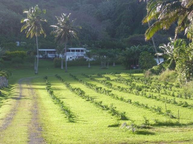
A plantation and its accompanying mansion - this is how the other 2% live in Rarotonga. And then I was moved forward firmly into the 21st century:
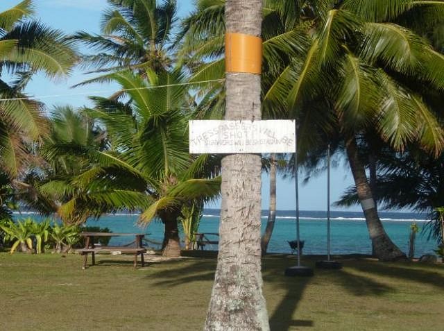
Muri Beach is my least preferred part of Rarotonga, mainly because of the conglomeration of arrogant, rich white Papaa who live there, and the appalling attitudes they have brought with them:
"Trespassers will be shot. Survivors will be shot too" - sign on a property with beach access. This is NOT the Pacific Way of doing things... Muri Beach is not a good place for walkers even if you are not trying to access the beach. The locals' dogs are generally quite friendly on Rarotonga but things are different along the ring road running along Muri Beach: there, the rich whites have trained their dogs to be mean and ferocious. Faced with a series of quite aggressive behaviour from dogs coming out to the roadside, I was forced take off my leather belt as a precaution should I need to defend myself. Things almost came to a head with one very aggressive dog that came belting down a driveway at me. Fortunately he decided I was more trouble than I was worth. What a contrast with the dogs owned by islanders in the vicinity of my motel on the outskirts of Avarua: after a couple of nights walking home in the dark there, one initially territorial dog got to like me to the point where he was coming out to say hello every evening and even jumped up to slobber me on the face.
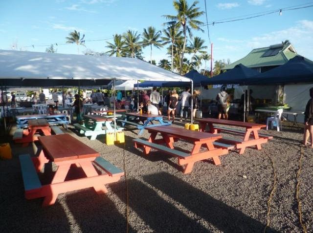
Anyway, I did find dinner at the food market. It was funny to see the very New Zealand cakes on offer as dessert, but then this IS the tourist strip:
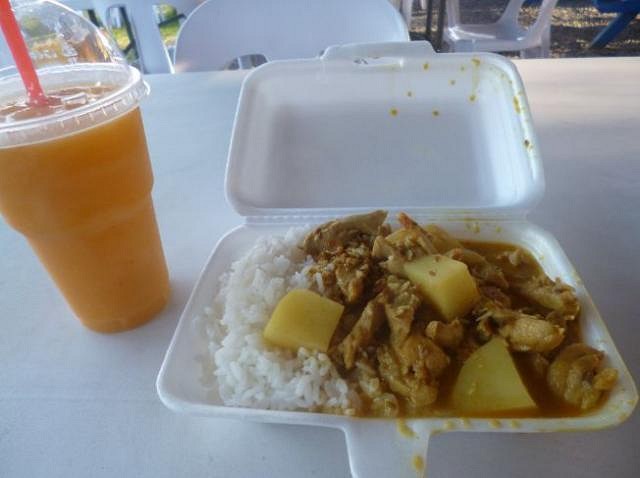
Dinner turned out to be Chinese:
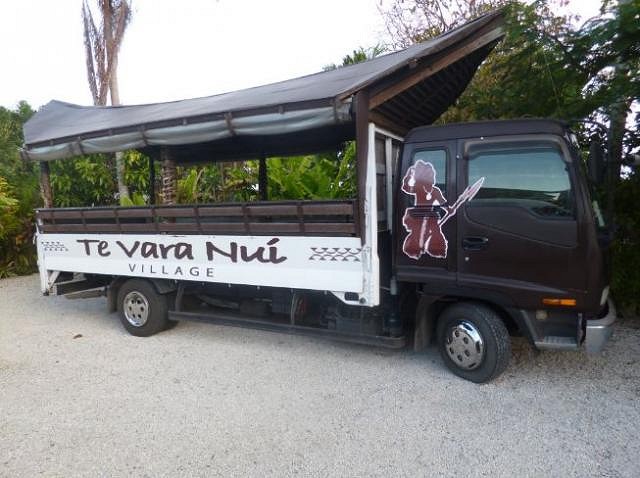
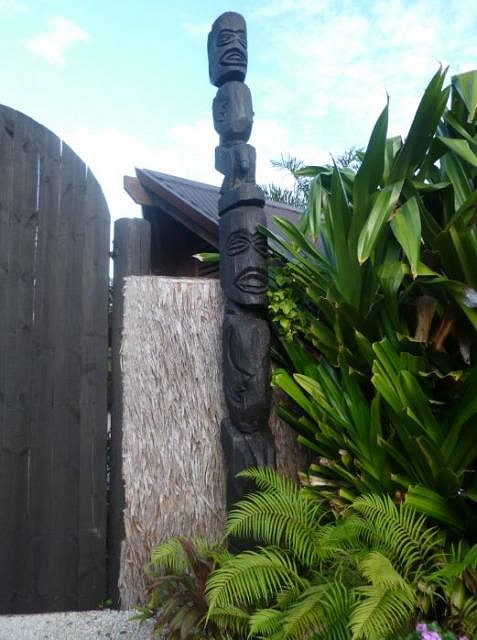
Afterwards I went over to have a peek at the site of the biggest Polynesian floor show on the island, with an impressive tiki gateway, about 12 feet high:
A peek inside:
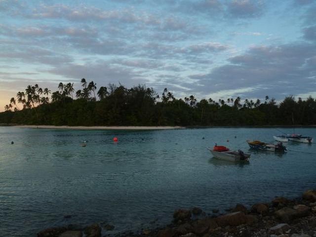
From Muri Beach I had quite a hike to get back to Avarua so I did not stick around. On the way though, I did take some time out to admire Avana lagoon, which was the departure point for one of the last great Polynesian trans-oceanic migrations. A fleet left from here circa 1350 to sail all the way to New Zealand:
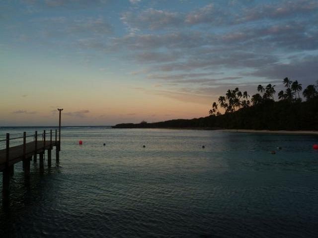
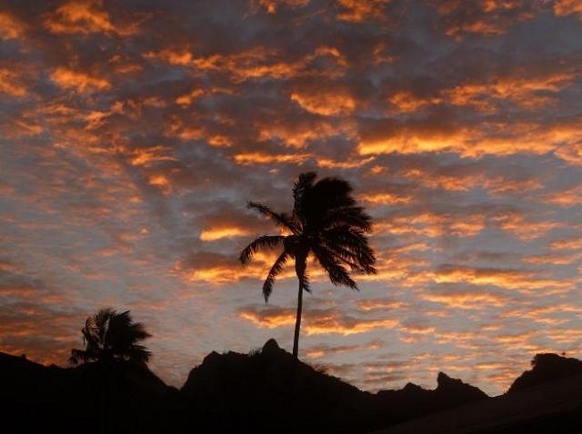
I still had about 15 kilometres to walk to get back to Avarua, but I was not complaining as I had the chance to witness one of Rarotonga's glorious sunsets as I walked along the roadside:
The final instalment of this tiki tour will offer a farewell to Rarotonga at its finest bar and restaurant...
[ Edited by: Club Nouméa 2016-09-21 08:00 ] [ Edited by: Club Nouméa 2016-10-10 16:15 ] |