Tiki Central / General Tiki
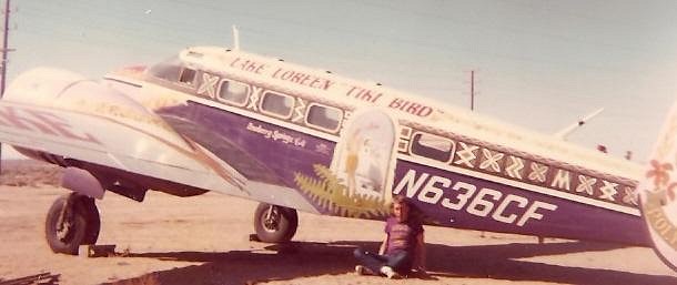
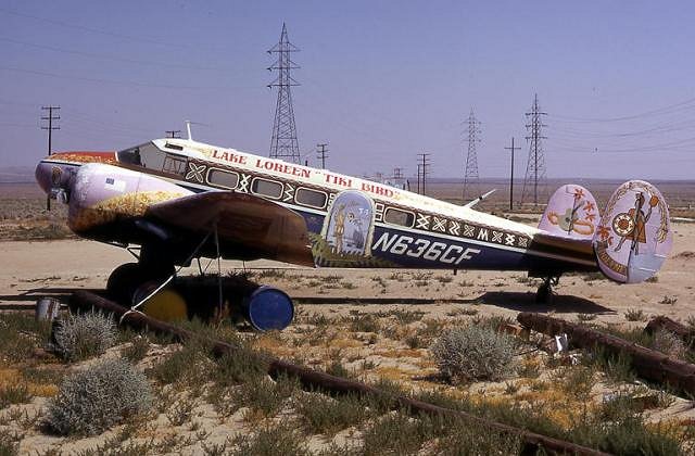
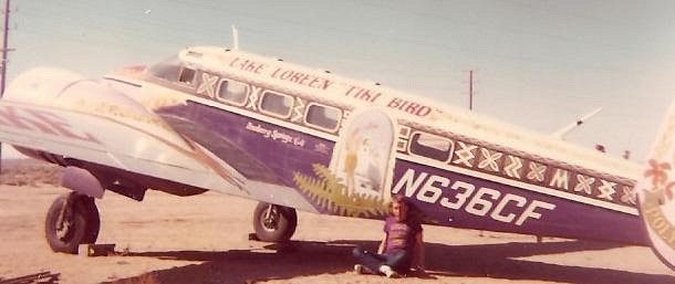
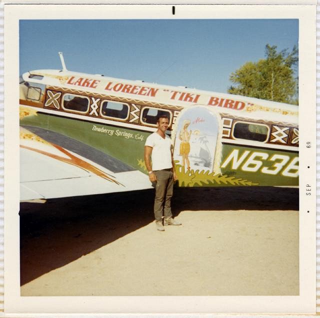
how cool is that - a tiki-plane ! ! !
|
I
icebaer69
Posted
posted
on
Tue, Mar 31, 2009 2:18 AM
obviously this cool guy was a tiki-fan ! found the pictures @ flickr ... ...and this info bout lake loreen: "... A 1966 Travelogue by Slim Barnard An oasis in the midst of one of America’s most magnificent deserts is springing up around two man-maid lakes in the Mojave, about 190 miles from Los Angeles. Silver Valley, a region rich in the lore of the Old West, now has two new attractions, Lake Kalikoa and Lake Loreen. Kalikoa will be the center of a residential and resort development, and Loreen already is known for its public fishing, picnicking and swimming facilities. Driving a 1965 Ford Country Sedan, we reached this section of the Mojave Desert via Highway 66. Leaving Los Angeles on the San Bernardino Freeway, we followed U.S. 66 past Barstow to the Needles turnoff. This road goes to Needles through Daggett and Newberry, the latter a small but important point in the desert because of its plentiful water. The wells of Newberry actually supply the water needs of such surrounding communities as Ludlow, Amboy and Essex. As the only source of water between it and the Colorado River, some 100 miles away, Newberry played a key role in the settlement of the desert. Today, its precious water is transported in railroad tank cars, each capable of carrying 10,500 gallons. It is not unusual to see strings of 24 or more tankers waiting on a siding, but trains can be filled with 250,000 gallons of water in three hours. The road to the lakes is found about a mile beyond Newberry School, and is well marked. The pavement ends a half mile short of the lakes, but the unpaved portion is in good condition. The desert seems to be empty, until the lakes abruptly appear, almost like mirages. Kalikoa is 20 acres, and Lake Loreen covers 34 acres, creating tow large sparkling mirrors of the blue sky. Charles Schreiber, developer of the first lake, showed us the building lots he is preparing, to be know as Kalikoa Estates. We also learned how Lake Loreen gained its lyrical name when Schreiber led us across the road to meet his neighbors. Loreen and Gus Raigosa welcomed us to the recreation area they have carved out of the desert. Both former aircraft employees from El Segundo, the Raigosas bought the lake site on a shoestring, and literally dug it out with a bulldozer. Their lake is stocked with catfish, bass, bluegill and trout, and they permit fishing for $2.50 per day. The daily limit is 5 trout, 5 catfish, 10 bass and 25 bluegills, but no state angling license is required. Besides fishermen, picnickers and overnight campers are welcomed for 50 cents a person per day. Visitors with boats may launch them but motors of more than 7 ½ horsepower are not allowed. The lakes are in the center of an area of great historical interest. For example, within a few miles are a group of 100-year-old covered wagons, the ruins of an early Army outpost and a one time mining camp. does this lake still exist or is it desert again nowadays ? |
|
N
nuKKe
Posted
posted
on
Tue, Mar 31, 2009 3:34 AM
wow - both Tiki AND Route 66 in one post! I love the airplane pic. |
|
R
RevBambooBen
Posted
posted
on
Tue, Mar 31, 2009 5:14 AM
I drove through there a few weeks ago. Saw the sign for the lake. Will be driving through there again this coming Monday and will check it out fo' sure. ( it's a shortcut to my favorite volcano via Las Vegas) Cool find! |
|
B
bigbrotiki
Posted
posted
on
Tue, Mar 31, 2009 8:28 AM
Great find! And Ben on a mission! I love Tiki Central! I love Tiki! There is always a new facet to be discovered, a never before seen use of the theme. Glad that the old Polaroids used to have a date imprinted on the edge. And I like that his Wahine is blond. :) |
|
R
RevBambooBen
Posted
posted
on
Tue, Mar 31, 2009 9:25 AM
Bob @ OA just mailed me and said it was an OA gig. ( never got off the ground though) We'll still make a drive by to see if anything is left. |
|
LLT
little lost tiki
Posted
posted
on
Tue, Mar 31, 2009 9:59 AM
MAN ON A MISSION! |
|
C
christiki295
Posted
posted
on
Tue, Mar 31, 2009 1:00 PM
But what happened to the plane? What a description! |
|
I
icebaer69
Posted
posted
on
Tue, Mar 31, 2009 1:17 PM
2 more pictures of this area at lake loreen:
is there a tiki-style-boat in the background (behind the mustang) ? and here some info (only 4 days old) about the cool guy - "... |
|
B
Beachbumz
Posted
posted
on
Tue, Mar 31, 2009 3:34 PM
What a cool plane and building.. Ben, I hope you find a killer Tiki Oasis out there at lake Loreen.. I found one other picture of the plane too...
Aloha |
|
D
Deckhand_Davy
Posted
posted
on
Tue, Mar 31, 2009 3:37 PM
It's amazing what some of ya'll are able to dig up! I'm with ya BigBro...I love Tiki Central!! :) |
|
I
icebaer69
Posted
posted
on
Tue, Mar 31, 2009 4:34 PM
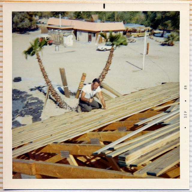
9/1969:
1971:
so the plane was obviously removed - |
|
I
icebaer69
Posted
posted
on
Tue, Mar 31, 2009 4:44 PM
i found this amazing info about LOREEN and GUS RAIGOSA And for the gourmet, there is a little Polynesian restaurant |
|
M
Murph
Posted
posted
on
Tue, Mar 31, 2009 5:41 PM
Here's another shot of the Tiki Bird
This was shot at a dirt airstrip in the California Mojave Desert, at a crossroads called Four Corners in August, 1973. |
|
M
Murph
Posted
posted
on
Tue, Mar 31, 2009 5:50 PM
A little more history of N636CF NTSB Identification: LAX85LA090 . THE PLT STATED THAT HE ENCOUNTERED LOW CEILINGS & FOG IN THE MOUNTAIN PASSES. AFTER SEVERAL UNSUCCESSFUL ATTEMPTS TO CROSS THE MOUNTAINS HE BELIEVED HE DID NOT HAVE SUFFICIENT FUEL ON BOARD TO REACH ANY AIRPORTS TO THE SOUTH SO HE SELECTED A FLAT MESA & EXECUTED A PRECAUTIONARY LANDING. THE TERRAIN WAS SMOOTH BUT SOFT & THE ACFT NOSED OVER. The National Transportation Safety Board determines the probable cause(s) of this accident as follows: Contributing Factors TERRAIN CONDITION..MOUNTAINOUS/HILLY |
|
B
bigbrotiki
Posted
posted
on
Tue, Mar 31, 2009 5:58 PM
Planes can fly, you know.... :) Kramer's Junction looks about 300 miles Northwest of Newberry Springs. The story of that development reminds me of the Salton Sea....desert Shangri La dreams.... .....Wow, I can't post fast enough for the findings pouring in here:
So did it really END UP there...the first shot at Kramers/Four Corners was in '71, that is only two years after they were working on the development down in Newberry Springs! Did they run out of money, and the plane was re-posessed? Or was Four Corners just one of the plane's regular Ports of Call? Earlier I noticed the letters "POLY..." on the plane tail fins...
...and now we can see the whole plane! But it looks like the rudder was painted over on the bottom... |
|
B
Beachbumz
Posted
posted
on
Tue, Mar 31, 2009 6:04 PM
Wow... All this info in under 12 hours...Great score Murph.. I LOVE TC TOO!! Photo was taken in "73" - 36 years later... still there???? Ben Your on a mission... Highway 395 and Highway 58 Junction.. Four Corners, Mojave... :wink: |
|
B
bigbrotiki
Posted
posted
on
Tue, Mar 31, 2009 6:07 PM
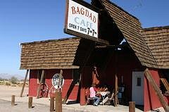
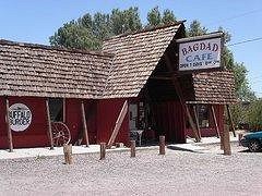
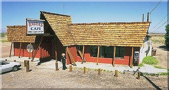
Wow, internet archeology is overtaking urban archeology: Found THESE shots of the Bagdad Cafe in Newberry Springs (sorry for the size, dragged from the web):
...and when looking at this photo again, I see a tiny A-frame peaking out way in the back!:
(Plus what looks like a Jaguar E-Type, quite a swank ride for this desert town!) |
|
B
Beachbumz
Posted
posted
on
Tue, Mar 31, 2009 6:24 PM
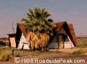
I found a shot of this place just down the road from where the Bagdad cafe is called the Bagdad Hut on http://www.roadsidepeek.com
Not sure what the story is with this place though... |
|
R
RevBambooBen
Posted
posted
on
Tue, Mar 31, 2009 6:25 PM
Bagdad is on 66 ( next to 40). Saw that the other week. Lake Laureen is closer to the middle between 15 and 40. Saw the sign for it and was trippin that there was a lake in the middle of no where. Actually, Mrs. Boo just reminded me that there was a lake off the road we were on that had hut structures but they were not that of Poly Pop. But then again, we drove past it not knowing at about 55. Will be back there on 4/6. |
|
B
Beachbumz
Posted
posted
on
Tue, Mar 31, 2009 6:30 PM
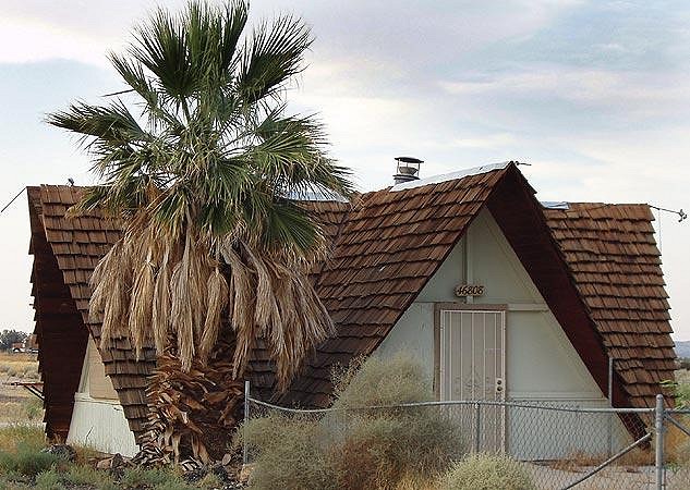
One more of the Bagdad Hut
|
|
B
bigbrotiki
Posted
posted
on
Tue, Mar 31, 2009 6:48 PM
Maybe there is a whole Desert Polynesia out there unbeknownst to us! Or these A-frames were just a sign of the times, non Polynesian all along... |
|
B
bigbrotiki
Posted
posted
on
Tue, Mar 31, 2009 7:22 PM
Quote from RoadsidePeek.com:
|
|
B
bigbrotiki
Posted
posted
on
Tue, Mar 31, 2009 8:13 PM
This just in, about the film's ACTUAL location, from Wikipedia: http://en.wikipedia.org/wiki/Bagdad_Café
The film was shot at what was then the Sidewinder Cafe in Newberry Springs, California, 50 miles west of the original site of Bagdad on old U.S. 66. Since then, the café has become something of a tourist destination, and has changed its name to the Bagdad Café. A small notice board on the café wall features snapshots of the film's cast and crew. |
|
B
bigbrotiki
Posted
posted
on
Tue, Mar 31, 2009 9:01 PM
Aaaaaaah, make it stop! (...must write Tiki shirt book...must get off the internet....): http://www.youtube.com/watch?v=uHMKVtvqULg&feature=related ...what can I say, I hate those cheap sunset grad filters: http://www.youtube.com/watch?v=OrFebK_VZjE&feature=related This one is only interesting because right of the bat it shows what I believe was the ORIGINAL Bagdad Cafe IN Bagdad, CA. Turn off the sound, or you will have to listen to this interminable song again!: (sorry, had forgotten to ad the link earlier) AND if you still can take it, here is extensive coverage of the interior with another interminable media phenomenon, Huell Houser, leaving us with more gosh/golly surface scratching, yet a complete lack of information as to the anything that happened in that burg pre-87. :) : http://www.youtube.com/watch?v=ImpGsMenmSs&feature=related What an irony to think that there is a whole fan community (for the movie) out there to whom the building has become an icon, yet they have no clue to its true origins. And that I, because I have painstakingly avoided this film, only stumble on it now, when otherwise this charming little A-frame would have aroused my curiosity much earlier. Just goes to show that the true Tiki archeologist should fear no hardship and trials --even if it means having to watch a German art film! [ Edited by: bigbrotiki 2009-04-01 07:03 ] |
|
R
RevBambooBen
Posted
posted
on
Tue, Mar 31, 2009 9:04 PM
Sven, It's only like 2.5 hrs from L.A. You otta go out there this weekend and check it out. It'll give me more time at my Volcano :) on Monday. Got to love Pisgah! ( recent pics on my facebook) |
|
B
bigbrotiki
Posted
posted
on
Tue, Mar 31, 2009 9:08 PM
Ha haaa, noooeeeeee, you got the job, pal! Your expert builders' and site surveying skills are needed to trace and track any and all remnants of Newberry Springs' glorious Polynesian past! |
|
R
RevBambooBen
Posted
posted
on
Tue, Mar 31, 2009 9:14 PM
Bastard! |
|
M
Murph
Posted
posted
on
Tue, Mar 31, 2009 11:11 PM
Looks like the Tiki Bird migrated to Alaska! Aircraft: BEECH C-45H (Fixed wing multi engine, Category: Land, Engines: 2, Seats: 10, Weight: Up to 12,499 Pounds, Speed: 165 mph), Engine: P&W R-985 SERIES (450 HP) (Turbo-prop) |
|
I
icebaer69
Posted
posted
on
Wed, Apr 1, 2009 1:43 AM
"... |
|
R
RevBambooBen
Posted
posted
on
Mon, Apr 6, 2009 8:37 PM
Drove around Newberry Springs today with Queen K. and the Boo Familia. Went to several lakes and oddities. THIS PLACE IS TIKI MECCA !!! Pics soon.......... |
|
R
RevBambooBen
Posted
posted
on
Mon, Apr 6, 2009 9:47 PM
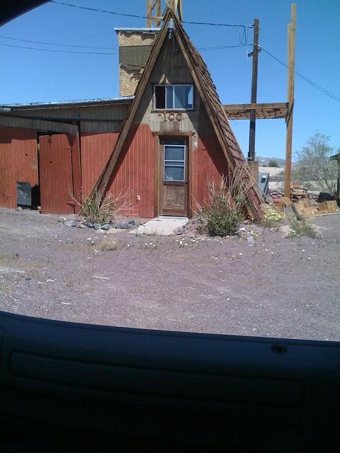
As Big Bro pointed out in this pic, "the A-Frame in the background"....
... was a swim up TIKI bar/boat up TIKI bar. The Locals told us it was the Best Lake to "get it on" back in the day. |
|
QK
Queen Kamehameha
Posted
posted
on
Tue, Apr 7, 2009 12:14 PM
Went to the california land management site and was able to find some cool info, I will post it in a few days. Amy |
|
B
bigbrotiki
Posted
posted
on
Tue, Apr 7, 2009 3:14 PM
Cool guys, can't wait! Didya find out the origin of the now Bagdad Cafe? |
|
R
RevBambooBen
Posted
posted
on
Tue, Apr 7, 2009 8:37 PM
Ummmm... it's on 66. Go check it out! 2.5 hours from LA. More soon on Lake Lareen. Quenn K. is Rockin it!!! |
|
R
RevBambooBen
Posted
posted
on
Wed, Apr 8, 2009 4:59 AM
NEW LAKES OF THE MOJAVE A 1966 Travelogue by Slim Barnard An oasis in the midst of one of America’s most magnificent deserts is springing up around two man-maid lakes in the Mojave, about 190 miles from Los Angeles. Silver Valley, a region rich in the lore of the Old West, now has two new attractions, Lake Kalikoa and Lake Loreen. Kalikoa will be the center of a residential and resort development, and Loreen already is known for its public fishing, picnicking and swimming facilities. Driving a 1965 Ford Country Sedan, we reached this section of the Mojave Desert via Highway 66. Leaving Los Angeles on the San Bernardino Freeway, we followed U.S. 66 past Barstow to the Needles turnoff. This road goes to Needles through Daggett and Newberry, the latter a small but important point in the desert because of its plentiful water. The wells of Newberry actually supply the water needs of such surrounding communities as Ludlow, Amboy and Essex. As the only source of water between it and the Colorado River, some 100 miles away, Newberry played a key role in the settlement of the desert. Today, its precious water is transported in railroad tank cars, each capable of carrying 10,500 gallons. It is not unusual to see strings of 24 or more tankers waiting on a siding, but trains can be filled with 250,000 gallons of water in three hours. The road to the lakes is found about a mile beyond Newberry School, and is well marked. The pavement ends a half mile short of the lakes, but the unpaved portion is in good condition. The desert seems to be empty, until the lakes abruptly appear, almost like mirages. Kalikoa is 20 acres, and Lake Loreen covers 34 acres, creating tow large sparkling mirrors of the blue sky. Charles Schreiber, developer of the first lake, showed us the building lots he is preparing, to be know as Kalikoa Estates. We also learned how Lake Loreen gained its lyrical name when Schreiber led us across the road to meet his neighbors. Loreen and Gus Raigosa welcomed us to the recreation area they have carved out of the desert. Both former aircraft employees from El Segundo, the Raigosas bought the lake site on a shoestring, and literally dug it out with a bulldozer. Their lake is stocked with catfish, bass, bluegill and trout, and they permit fishing for $2.50 per day. The daily limit is 5 trout, 5 catfish, 10 bass and 25 bluegills, but no state angling license is required. Besides fishermen, picnickers and overnight campers are welcomed for 50 cents a person per day. Visitors with boats may launch them but motors of more than 7 ½ horsepower are not allowed. The lakes are in the center of an area of great historical interest. For example, within a few miles are a group of 100-year-old covered wagons, the ruins of an early Army outpost and a one time mining camp. Pioneer Life The wagons were bought into the area by Mormon settlers, and today form the nucleus of a youth camp operated by the Baptist Church of Ontario. Each wagon is being fitted to sleep four youngsters, and all are arranged in a semi-circle around a campfire in the traditional night formation of the pioneers’ wagon trains. A few miles farther, the century-old ruins of Fort Cady, one of the early outposts established to protect travelers and settlers, still survive as part of the desert scene. Built by General James B. Carleton, whose California Column cleaned Confederate General H. B. Sibley out of Arizona and New Mexico during the Civil War, the fort was placed near the junction of the San Bernardino-Salt Lake and Santa Fe Trails. It held the unenviable reputation of having the highest number of desertions in the United States Army. The fort was considered to be one of the worst assignments in the Army because of its remoteness and the savagery of the surrounding Indians. Early Perils More than 2,000 wagons per year sought its protection before Fort Cady was abandoned in 1870, and archeologists are now probing its ruins for clues to the life once led within its walls. The fort’s sutlers store was located a half mile south on a ranch now owned by Ken Wilhelm. The sutlery, sort of a privately owned PX, was raided many times by the reckless soldiers from the fort. Wilhelm charges visitors $1 per car during winter months, and $1.50 in the summer. Visitors are on the honor system, and may deposit the fee in a can at the gate. The ranch property on the banks of the Mojave River is a pleasant place for picnics and swimming. Frog hunting is also excellent along the river. Fort Cady also was the shipping point for gold from the mining camp of Alvord, one of the oldest towns of its kind in the West. Alvord boasted its own gold mill, and shipped it out as bullion by stagecoach. Alvord is reached via a dirt road from the highway that leads to Las Vegas. Its three miles are passable in good weather, but should not be attempted within three days following a rain. The first sign of the town is an ancient pump made of huge timbers, and used in the early days to lift water over the top of a mountain to the mine workings. The mine has been owned since 1912 by the Hart, Schafner and Marx clothing interests, and was worked until 1952. Staying overnight at Lake Loreen, where we enjoyed an excellent Cantonese dinner, we started home the next day via a dividend stop where we could find semi-precious stones. Near the village of Poe, a road marked “Lake Havasu” leads through lava beds to a hillside that is rockhound’s delight. Agate and jasper lie on the ground for the taking, and Dell Woodin, of Lake Loreen, led us to some splendid specimens. As can be seen, the desert is alive with happy things to do and see, making a weekend full of fun and excitement at any time of year. Motels available at Barstow, 20 miles away at $8 and $10 per night for two. Queen K. and I are going back in a month to do some more research. Keep an eye out! |
|
R
RevBambooBen
Posted
posted
on
Wed, Apr 8, 2009 5:07 AM
p.s. check this one out!!! http://mojavedeserttrails.com/lakehiri/svworld.htm Hmmmm....
Bamboo Ben [ Edited by: RevBambooBen 2009-04-08 05:09 ] |
|
R
RevBambooBen
Posted
posted
on
Wed, Apr 8, 2009 5:22 AM
-----Original Message----- Hi Ben: |
|
QK
Queen Kamehameha
Posted
posted
on
Wed, Apr 8, 2009 10:52 AM
Sven, the Bagdad cafe was called the "sidewinder cafe" it is noted in the article ben posted and on this site: http://www.bagdadcafe.us also this, from another site "Bagdad Cafe, a movie centering on old Route 66, was filmed in the Newberry Springs area. The Bagdad Cafe located in Newberry Springs is not the original Bagdad Cafe, the original cafe was located in the town of Bagdad between Amboy and Ludlow on old Route 66. Nothing remains of the old cafe in Bagdad. The Newberry Springs cafe is a Route 66 survivor though and was originally known as the Sidewinder Cafe. After the movie was filmed here the name Bagdad Cafe just seemed to stick. It is open for business today serving breakfast, lunch and dinner. If you are coming through the area I would recommend stopping here. Say hi to Andrea Pruett, the proprietor, while you're at it. She has done a great job of keeping the Bagdad Cafe alive for all us Mother Road fans. If you're lucky, maybe General Bob will show up and entertain you with his colorful stories from the past" Amy [ Edited by: Queen Kamehameha 2009-04-08 10:55 ] |
|
B
bigbrotiki
Posted
posted
on
Wed, Apr 8, 2009 12:04 PM
Guys. It is admittedly hard to follow my train of thought sometimes, but: I know all that, I established it on page two of this thread:
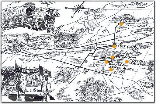
To clarify how I was lead astray: The PLANE spells Lake Loreen and Newberry Springs... This building (whatever its name!)... So when Icebear quoted the Desert Magazine April 1966 article (on page 1 of this thread!) with: I simply should have followed Icebear's link to the Desert Magazine Travelogue on page 1 (as we all :wink: ), and I would have noticed that the Sidewinder name is mentioned in the same article than that quote, so there's NO WAY the two could have been the same place! :roll: THEN I would have also seen the MAP that shows the distance between Newberry Springs and Lake Loreen:
..and I would have had a visual of the separateness of the two places. I know Ben mentioned that, but that was just a drive-by survey then, right? Now I understand that the town of Newberry Springs has probably nothing to do with the Desert Polynesia at Lake Loreen/Lake Kalikoa. Somebody just wrote that on the plane to mislead me. :D |
|
BPB
Bay Park Buzzy
Posted
posted
on
Wed, Apr 8, 2009 12:23 PM
Yep! It's as clear as mud now! So do you think the lake was formed with water from the springs? I guess I'll go back and refamilarize myself with page 2 of this thread now? Or was it page one? Something about a plane... |
|
QK
Queen Kamehameha
Posted
posted
on
Thu, Apr 9, 2009 6:42 PM
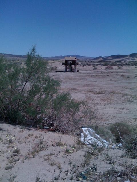
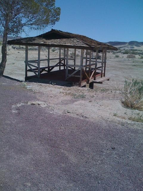
Well, the Monday searching was interesting for sure, the place we found wasn't lake Loreen, but a real estate person I spoke with yesterday said there was nothing left of Lake Loreen, but that "gus" who built it had 2 other lake sites with homes that are still active and are nice communities, not Tiki and in Newberry springs :) The place we found was built by a dentist who liked lake loreen, so it is similar, here are some pictures, the dry lake you will see is 4 acres and was filled in the 60's when the dentist built it, it has a house on stilts in the middle of the dry lake that was only accessible from a boat. it has numerous trailer hook ups too. we didn't stay too long as it was someones home.
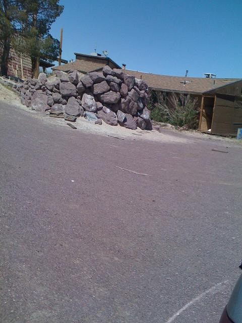
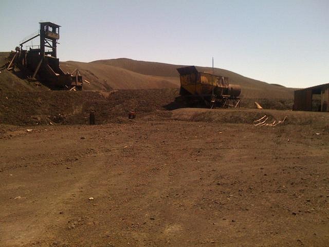
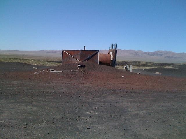
Then we went to the Volcano, where we loaded up on tons of lava rock, which I have been riding around with all week waiting on the weekend. It was a weird and strange place, with rusting abandoned equipment, I would not go there alone, good thing Bamboo, Vicki and the family were there :)
Amy [ Edited by: Queen Kamehameha 2009-04-09 18:47 ] |
|
I
icebaer69
Posted
posted
on
Fri, Apr 10, 2009 5:14 AM
that´s crazy - maybe in some dozen years las vegas has the same fate |
|
B
bigbrotiki
Posted
posted
on
Fri, Apr 10, 2009 11:15 AM
That's kinda what I expected: A smaller version of the Salton Sea dream that dried up. Sooo...Benster... is that IT? |
|
QK
Queen Kamehameha
Posted
posted
on
Fri, Apr 10, 2009 2:19 PM
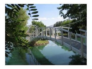
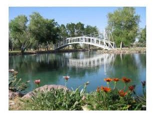
Sven, I am not Ben, but the woman who I spoke with told me all the lakes are man made and all the homes have wells, so this dry lake could easily be filled if the owner wanted to. The tax to fill a 4 arces lake is about 15.00 plus the maintainence, lots of clay to hold the water, equals lots of $$$ On lake Loreen, it was just abandoned when it didn't work and his other 2 properties took off. If your ever out that way, its a great drive, to see these lakes and some have bridges and really something out in the middle of no where. Amy [ Edited by: Queen Kamehameha 2009-04-10 14:22 ] |
|
B
bigbrotiki
Posted
posted
on
Fri, Apr 10, 2009 2:38 PM
It's...it's just that he PROMISED :cry: :
He made my mouth water, and now it's just full of sand... |
|
QK
Queen Kamehameha
Posted
posted
on
Fri, Apr 10, 2009 2:43 PM
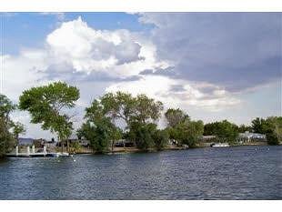
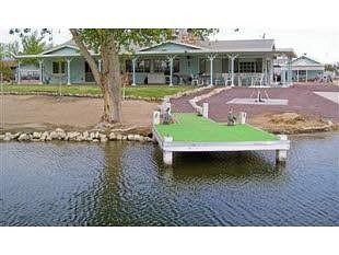
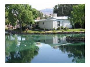
LOL Sven, He should post pictures, I have a few of the other lakes I could post and I am going back soon, so do let me know what you would like to see and I will try to get it. Amy these are from current real estate listings in Newberry springs, I don't think it's drying up any time soon Ben, post those pictures... :)
[ Edited by: Queen Kamehameha 2009-04-10 14:52 ] |
|
B
bigbrotiki
Posted
posted
on
Fri, Apr 10, 2009 3:42 PM
|
|
R
RevBambooBen
Posted
posted
on
Fri, Apr 10, 2009 9:32 PM
Sven, I misplaced my card that has the shots of all the tikis. I'm hoping it didn't fall out of the bag at the volcano. |


